Storyboard
Visualising Future Amenities & Connectivity.
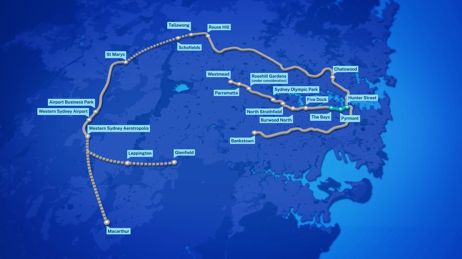
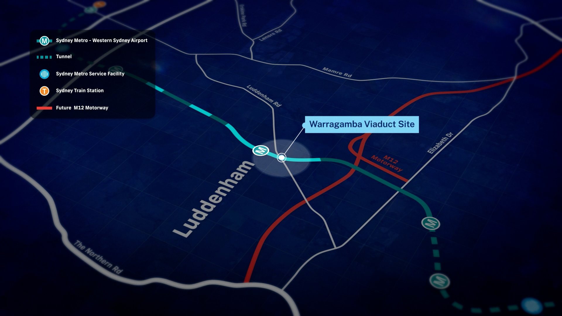
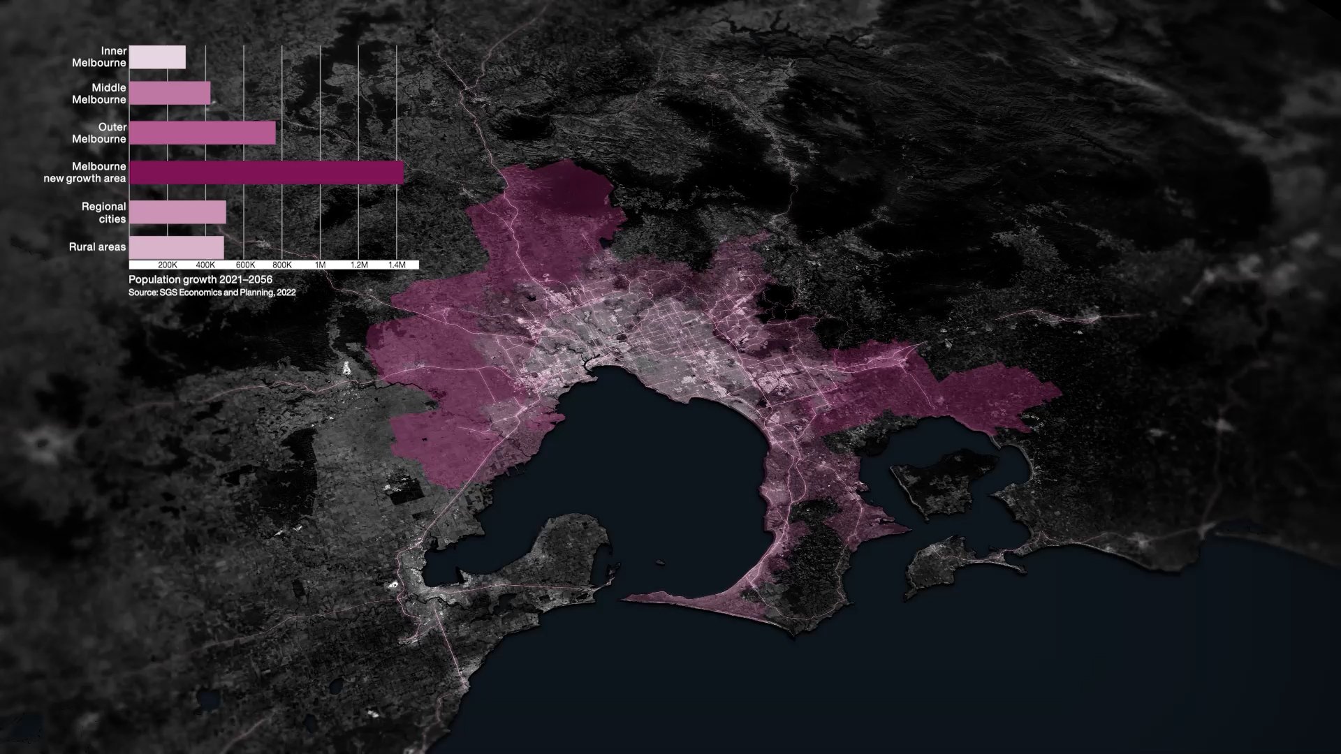
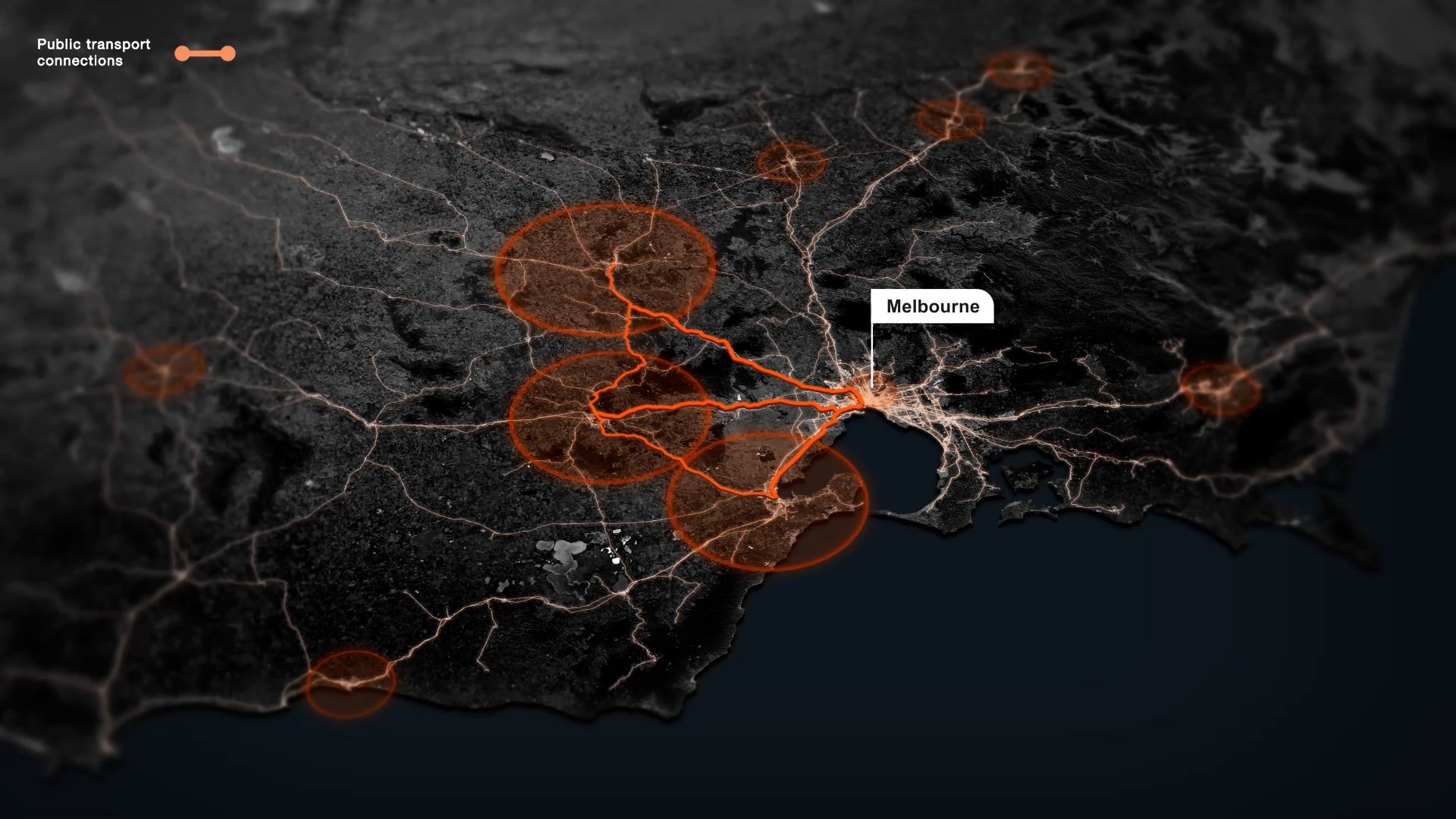
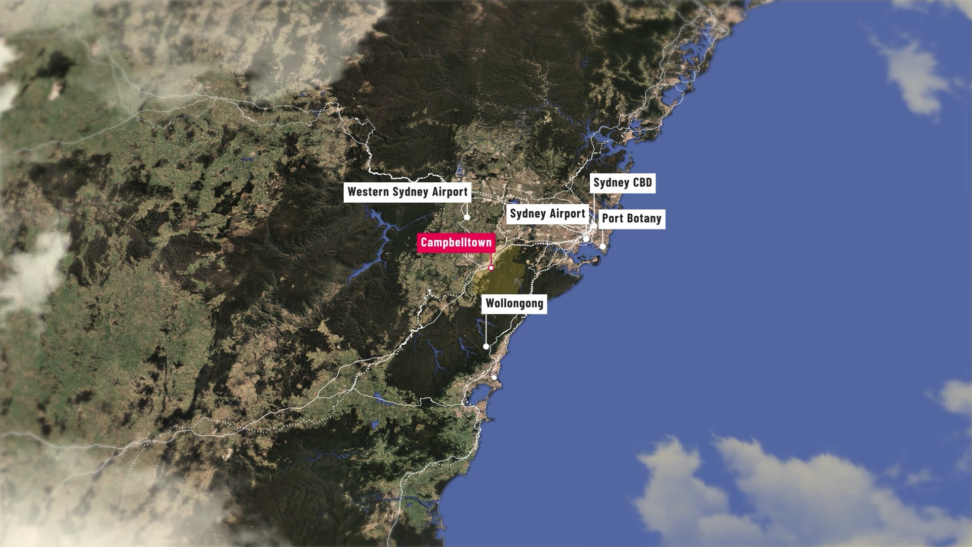
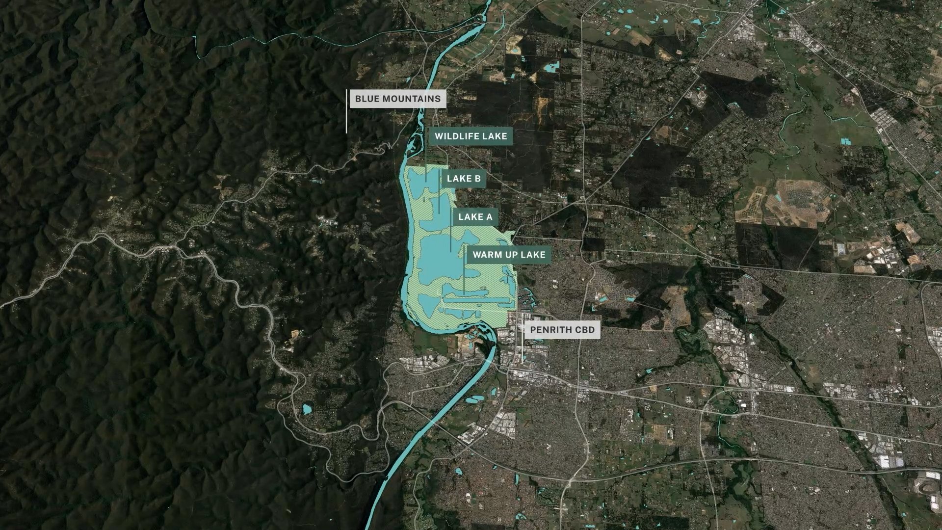
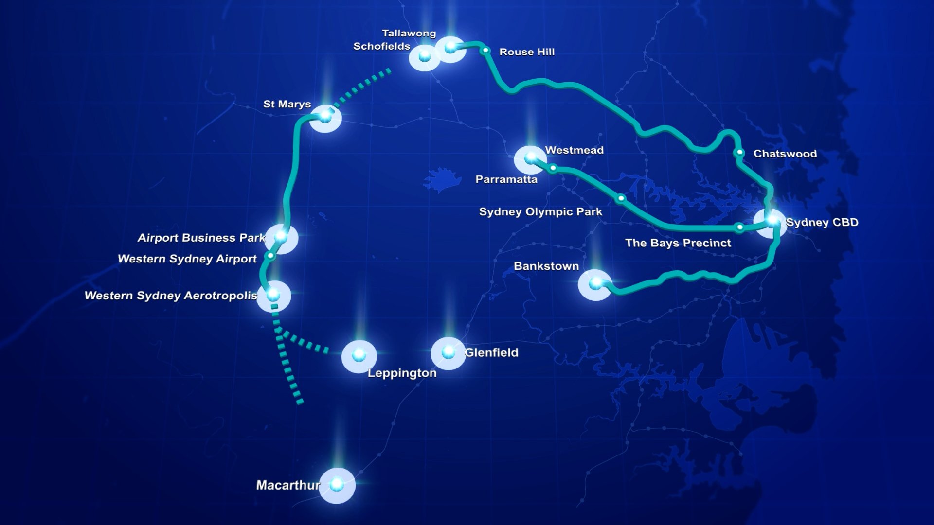
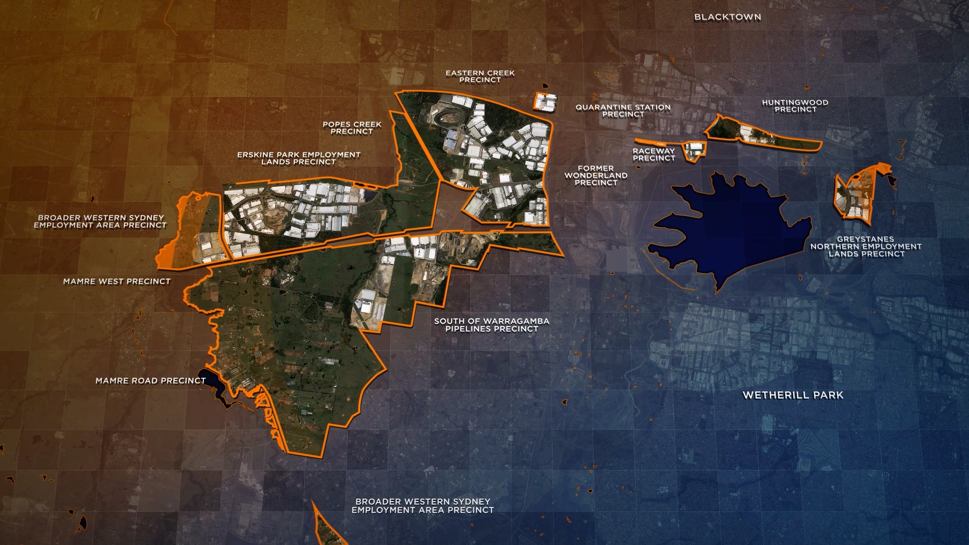
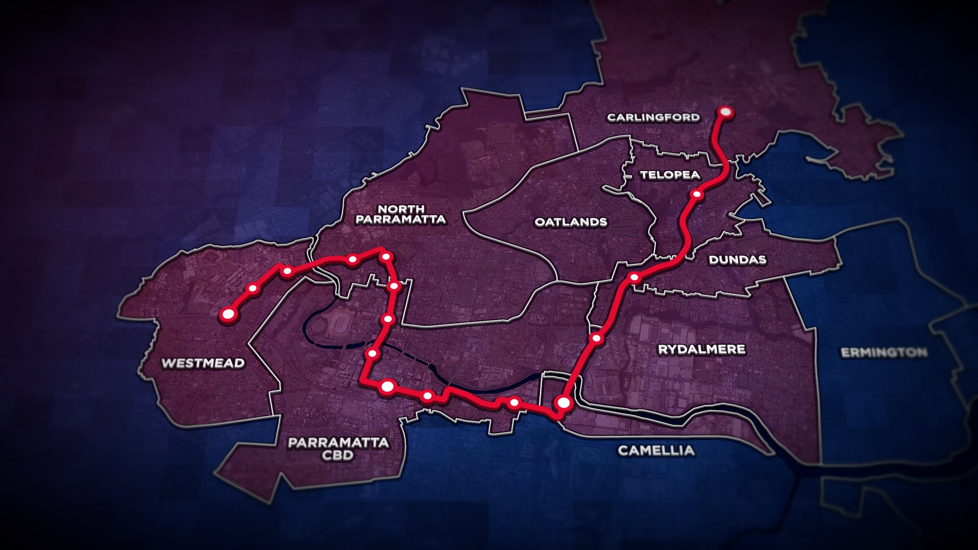
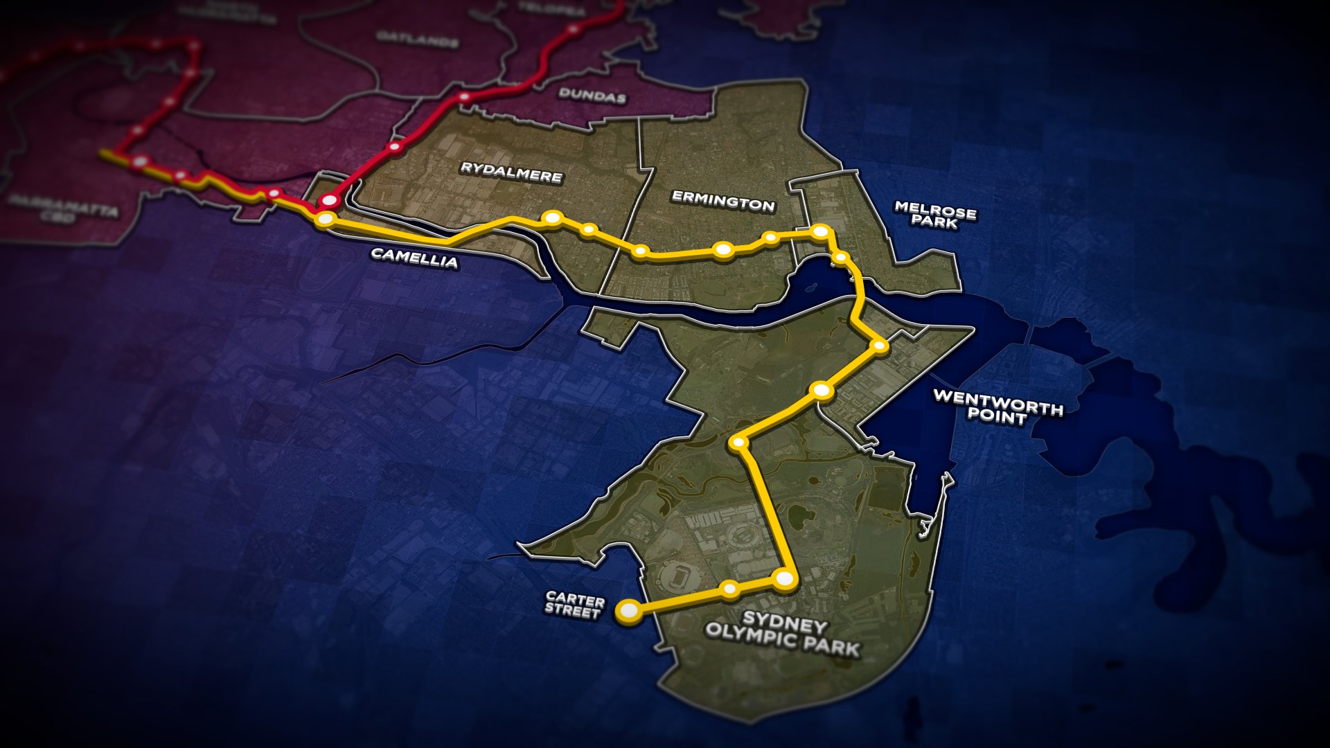
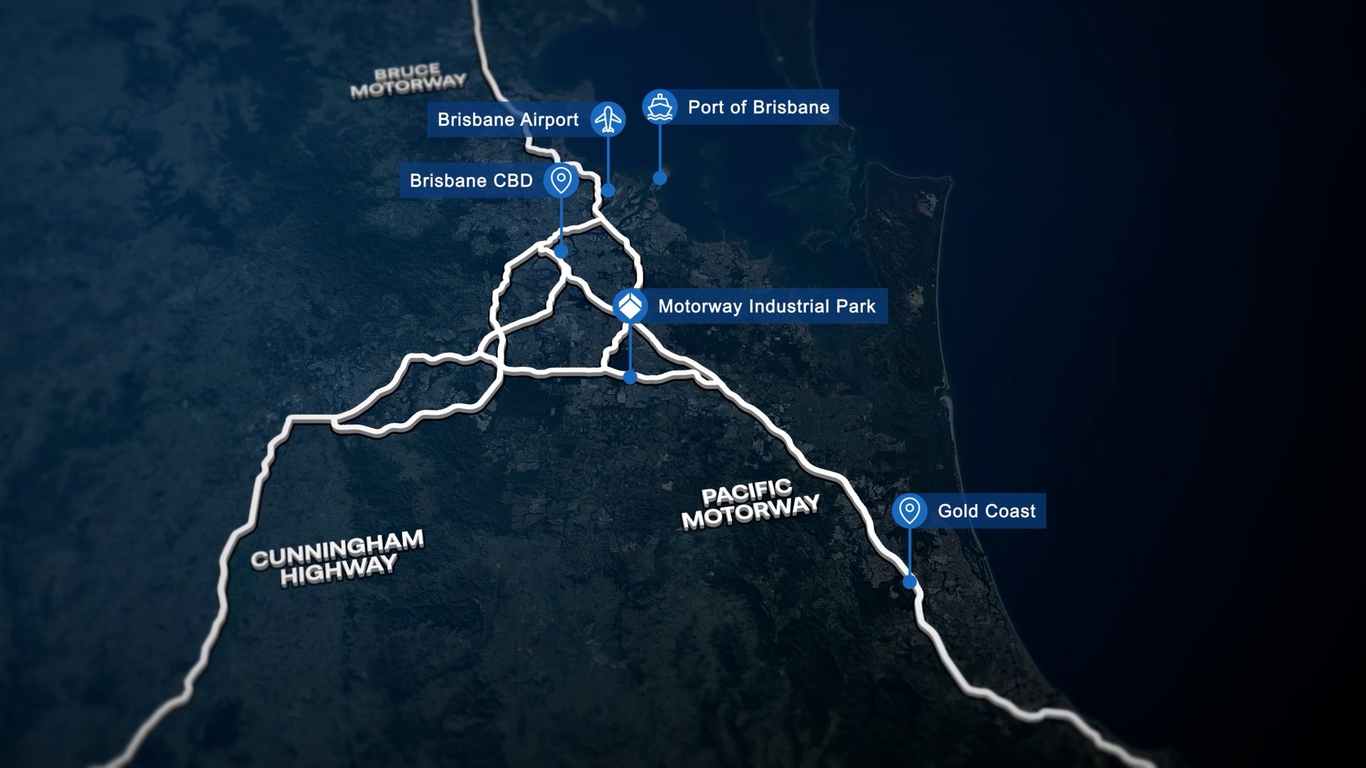
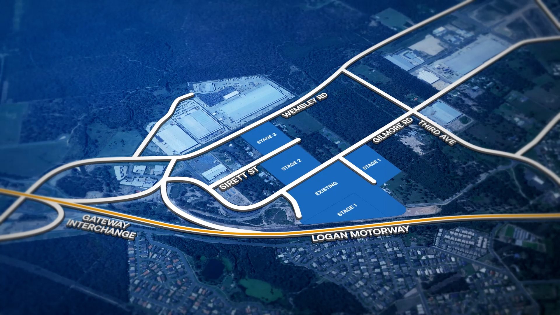
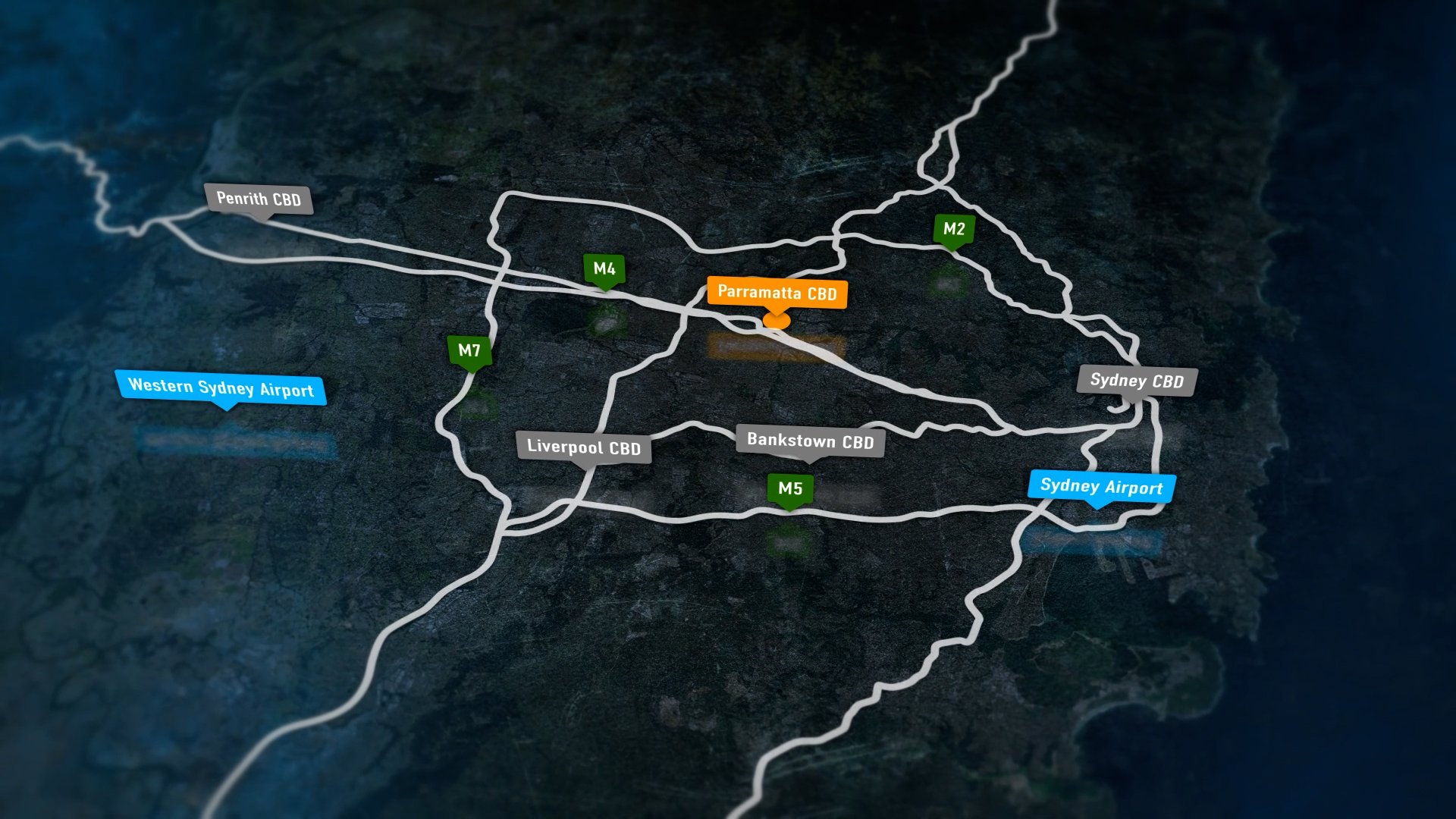
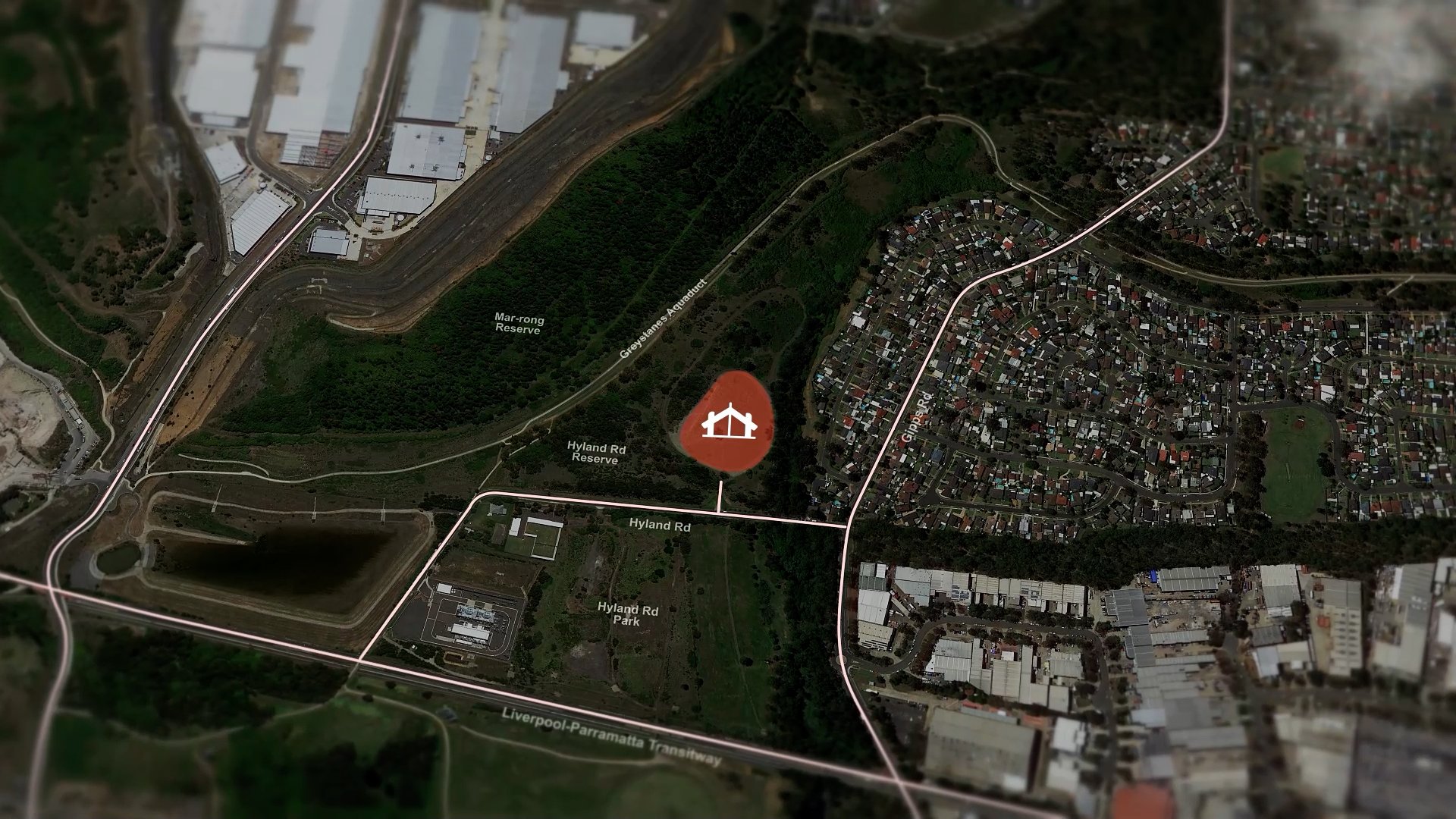
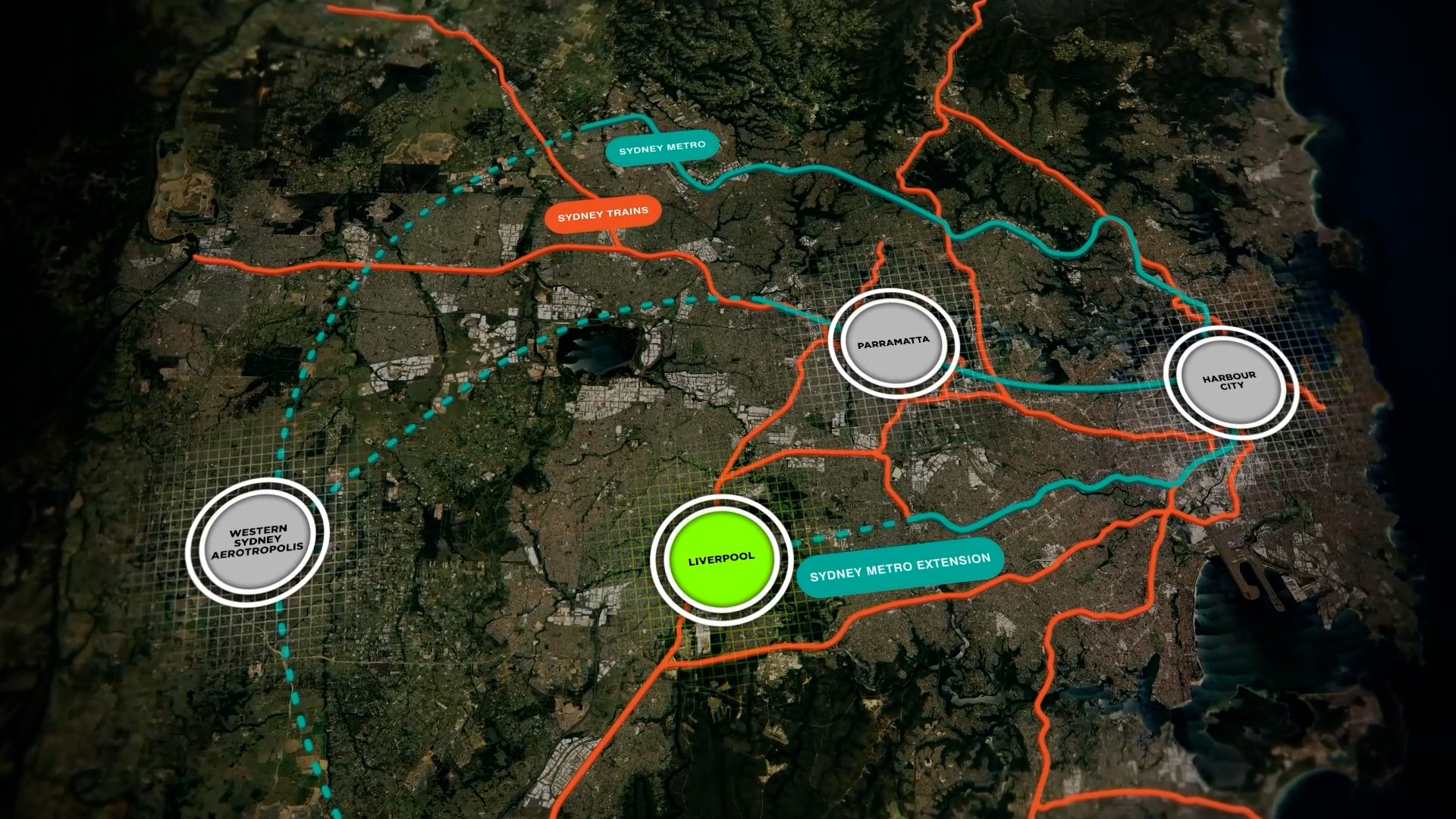
Animated & Interactive maps showcasing future transport corridors, connections to new airports, and amenities dynamically illustrate planned infrastructure developments and their impact on accessibility. These maps enable investors to see potential growth and opportunities, while helping the community understand enhancements in connectivity and access to essential services, ultimately boosting the area's attractiveness and value.
Animated Construction Simulation
Interactive Maps
Map styles